
The single most common question we get from guests is some version of "what should we actually do in Sequoia, and how long does it really take?" — usually arriving in our inbox at 9 PM the night before they show up.
So here it is: the day-in-Sequoia itinerary we'd send our own family. It assumes you wake up in one of our riverfront homes in Three Rivers, drink a cup of coffee on the deck, and head into the park around 8:30 AM. By dinner you're back on the river, your kids are wrecked in the best possible way, and you've seen the things the park is famous for without rushing or feeling like you missed something.
The day at a glance
- 8:30 AM — Leave Three Rivers via Highway 198
- 8:45 AM — Foothills Visitor Center (pee, get a junior ranger book if you brought kids)
- 9:30 AM — Hospital Rock pictographs (10-minute walking stop)
- 10:30 AM — General Sherman Tree (the world's largest tree by volume, 30 minutes round-trip)
- 11:30 AM — Big Trees Trail loop around Round Meadow (1 mile, easy, the postcard you came for)
- 12:30 PM — Lunch at Lodgepole picnic area (pack it from Three Rivers, see "what to bring" below)
- 1:30 PM — Moro Rock (350 stairs, 20-minute climb, the view is worth it)
- 2:30 PM — Crystal Cave (half-day in itself — book ahead, see below)
- 4:00 PM — Drive back down to Three Rivers
- 5:00 PM — Back on your deck, feet in the river
The total drive from any of our homes to General Sherman is about 50 minutes if you don't stop. The reason it feels longer is that Highway 198 climbs from 800 feet of elevation in Three Rivers to 6,400 feet inside the park — that's a real mountain road, not an interstate.
The drive in: what to know about Highway 198
Highway 198 is the only road from Three Rivers to the park's Foothills entrance. It's two lanes, twisty, and beautiful. Allow 45 minutes from any of our homes to General Sherman parking.
Three things that catch every first-time visitor:
- The road inside the park is narrower than the road getting there. Once you pass the entrance kiosk, you're on the Generals Highway — a 1930s-era road designed for Model A traffic. Vehicles longer than 22 feet aren't allowed between Potwisha Campground and the Giant Forest Museum, and anything over 24 feet isn't advised on the Foothills section either. If you're in something larger, rangers will redirect you out of the park entirely — Big Stump is your only oversized-vehicle option, and it's a long detour.
- There's no gas inside the park. Top off at the Chevron in Three Rivers before you go. Gas is also notably cheaper here than anywhere else for 50 miles.
- Cell service drops at Hospital Rock. Download offline maps + a podcast before you leave town. Don't rely on Google Maps for anything beyond the entrance — there is no signal at General Sherman, Moro Rock, or Crystal Cave.
Stop 1 — Foothills Visitor Center (8:45 AM)
About a mile past the Ash Mountain entrance sign, on the right. Use the bathroom now (it's the cleanest one you'll see all day), pick up a Junior Ranger booklet for any kids age 5+ (small fee, three age tracks: 5–8, 9–12, 13+), and check the chalkboard at the front desk for trail closures or wildlife warnings. In late summer they post bear-activity reports — usually nothing dramatic, but the rangers know which trails to skip.
The exhibit hall takes 10 minutes if you're moving fast. Skip the gift shop until later — there's a better one at Lodgepole.
Stop 2 — Hospital Rock pictographs (9:30 AM)
Hospital Rock is a Yokuts gathering site at the bottom of the canyon, on the right side of Highway 198, with a small parking pullout and a covered picnic shelter. The pictographs are on a low rock face 100 feet from your car. You won't need more than 15 minutes here, but it's a nice break to stretch your legs and the canyon view from the picnic area is one of the best on the road. If your kids want to scramble on the giant boulders, give them 20 minutes.
This is also the last reliable bathroom for an hour, until you reach Lodgepole.
Stop 3 — General Sherman Tree (10:30 AM)
This is the thing you came for. The world's largest tree by volume — 275 feet tall, about 25 feet across at the base (roughly 103 feet around), an estimated 2,300–2,700 years old. Park at the main General Sherman Tree lot off Wolverton Road; the trail down is half a mile with about 200 feet of descent.
The walk down is wheelchair-accessible (paved). The walk back up is not — it's a 200-foot elevation gain at altitude, and people in flip-flops regret it. Plan 45 minutes round-trip, including time to gawk.
If your kids are very small, there's a shuttle from the Sherman Tree lot to the tree itself — also paved, also accessible.
Stop 4 — Big Trees Trail loop (11:30 AM)
The Round Meadow loop is a 1-mile flat boardwalk through old-growth sequoias circling a wet meadow. This is the postcard. If you only do one walk in the park, do this one. There's a shorter option (a quarter-mile spur to the meadow viewpoint) if anyone in the group is wiped out from Sherman.
The trailhead is a five-minute drive from the Sherman Tree shuttle stop. Restrooms at the trailhead. Allow 45 minutes for the full loop.
Stop 5 — Lunch at Lodgepole (12:30 PM)
Two options:
- Pack it from Three Rivers. Sandwiches, fruit, chips, water — you'll eat at the Lodgepole picnic area on the river. There's no Whole Foods inside the park; the cafe at Lodgepole is fine but slow at peak hours.
- Eat at Lodgepole Market & Snack Bar. Burgers, pizza by the slice, a coffee bar, a small grocery section. Plan 45 minutes if there's a line.
We pack our own. The picnic area on the Marble Fork of the Kaweah is the best lunch spot in the park, and the line at the snack bar can run 30 minutes in July.
Stop 6 — Moro Rock (1:30 PM)
Moro Rock is the giant granite dome you can see from the park entrance, three miles up Crescent Meadow Road. To get to the top: about 400 carved stone steps, roughly 300 feet of elevation, and one of the best 360-degree views in the lower Sierra. On a clear day you can see Mount Whitney (the tallest peak in the contiguous US) from the summit.
Plan 20 minutes up, 15 minutes at the top, 15 minutes down. Wear actual shoes — flip-flops on damp granite is how people roll an ankle. The handrail is there for a reason.
One quirk: Crescent Meadow Road is closed to private vehicles on summer weekends and holidays (late May through early September). On weekends, park at the Giant Forest Museum and take the free shuttle (add 20 minutes). Weekdays in summer + the off-season, you can drive in.
Stop 7 — Crystal Cave (2:30 PM, optional)
If you're cave people, this is non-negotiable. If you're not, skip it and head back to the river.
Crystal Cave is a marble cavern with stalactites, underground streams, and tour-only access. You must reserve tickets in advance at Sequoia Parks Conservancy — they sold out completely the prior season, so book several weeks ahead in summer. The 2026 season runs roughly May 22 to November 1.
The tour itself is 50 minutes. Add 30 minutes drive each way from Sherman + 15 minutes walk down to the cave entrance. So budget 2.5 hours for the whole detour. The cave is 50°F year-round; bring a sweater.
If you have kids under 6 or anyone with mobility issues, the walk down to (and back up from) the entrance is steep. We usually skip it when we host families with little kids and instead do an extra hour at the Tunnel Log + Auto Log on the way out — also iconic, also free, no reservations.
Stop 8 — Back to the river (4:00 PM)
The drive back down is faster than the drive up — you're descending, and the road feels familiar by now. Allow 45 minutes from General Sherman to Three Rivers.
Stop at the Three Rivers Mercantile or one of the village markets on your way back for last-minute essentials, or grab takeout from one of the spots in our Three Rivers restaurant guide.
By 5 PM you're back on the deck. The kids will be in the river within 10 minutes of arrival.
What to pack (the short version)
Year-round, regardless of season:
- Water bottle for everyone (you can refill at any visitor center)
- Snacks — pack twice what you think you'll need
- Layers — the temperature swing between Three Rivers (hot) and Giant Forest (40°F cooler) is dramatic
- Sunscreen + a hat — even in winter the high-elevation sun burns
- Cash — Crystal Cave gift shop and some food vendors don't take cards reliably with the spotty connection
For a deeper packing list — including what to bring in winter — see the full Sequoia packing guide.
What we'd skip
In the interest of an honest day-trip plan: a few things we don't recommend for first-timers.
- Mineral King. A 25-mile, 90-minute drive on a single-lane road with 698 turns. Stunning, but it's a separate day trip, not part of a Sequoia day plan.
- Tokopah Falls. A beautiful 4-mile round-trip hike from Lodgepole campground. If you have kids over 10 and they're hikers, do it instead of Crystal Cave. If they're under 10, skip — the trail is rocky.
- Buying lunch at the lodge restaurants. Wuksachi Lodge has a decent dinner spot but lunch is overpriced and slow. Pack from Three Rivers.
The right home for this trip
If you're staying with us and planning this kind of day, look for the homes closest to the park entrance on the Main Fork — they get you in early and back to the river fastest. Filter the stays by drive time to find the quickest starts.
We'll see you on the deck after.
Where to sleep
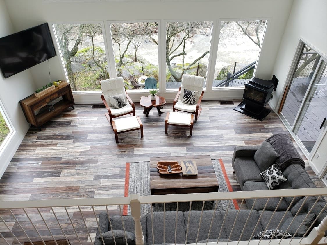
Sierra River House
Riverfront on the Main Fork, 5 min to Sequoia
Sleeps 85 min to SequoiaGame roomRiverfront5 min to Sequoia$400.00 / night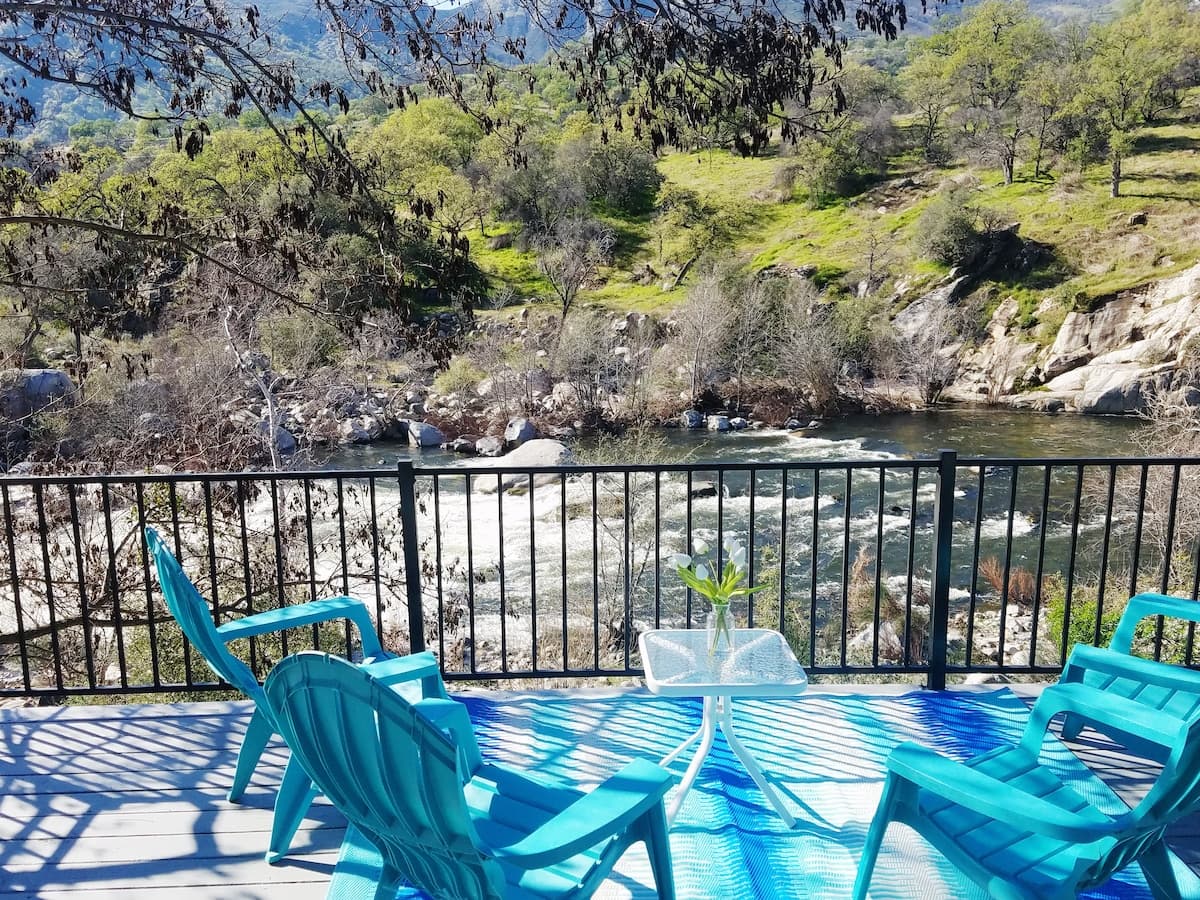
Kaweah River House
1/2 mile to Sequoia gate, riverfront
Sleeps 81 min to Sequoia1 min to SequoiaRiver viewsGame room$425.00 / night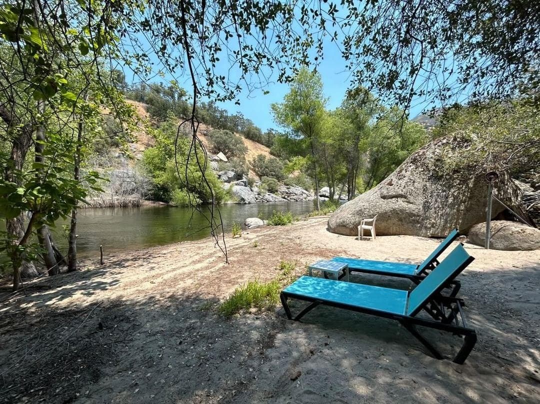
Retro River Casita
Couples studio with private river beach
Sleeps 21 min to Sequoia1960s retroPrivate beachFor couples$200.00 / night